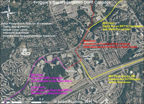
The set will become a repository for the maps I create showing various transit concepts in the DC area, including my proposal for around Mark Center:
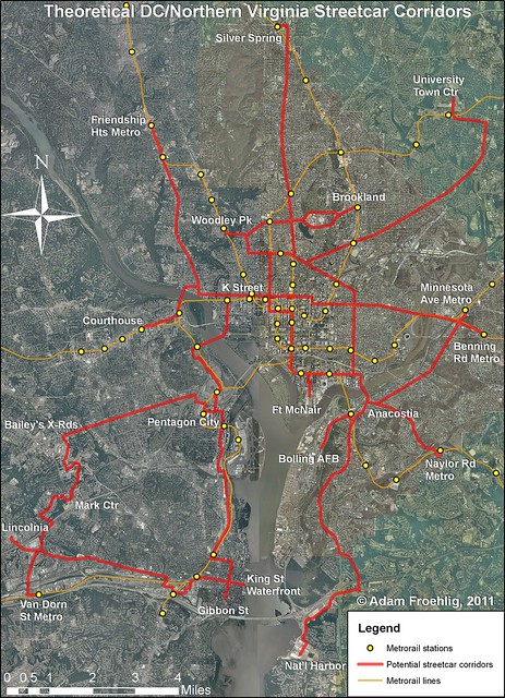
Or potential streetcar corridors:
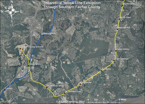
There's also my oft-mentioned proposal to extend the Yellow Line to (and beyond) Fort Belvoir:
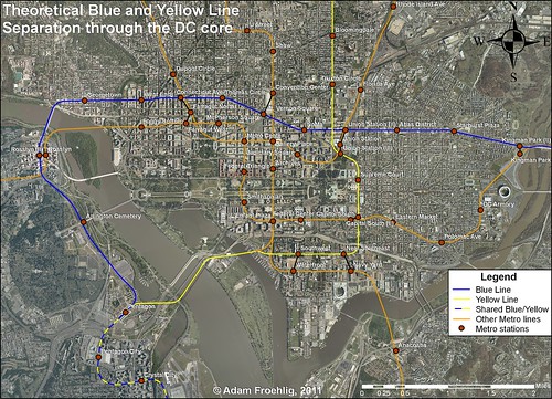
Lastly, there's been a lot of talk about a separated Blue Line through DC (with a separated Yellow Line thrown in for good measure):
More maps will be posted to the Flickr set as they're created.
No comments:
Post a Comment