Showing posts with label Northern Virginia. Show all posts

July 26, 2012

A thought on bus shoulder lanes...

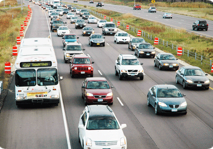
Last week, BeyondDC had a short piece on the potential for expanded bus shoulder use in the DC area. The area's Transportation Planning Board is asking for a working group to study the concept.

I'm sure BDC is aware of this, so I'm surprised he didn't mention it, but the Twin Cities metro area has a very extensive system of bus-allowed shoulders, where buses can use the shoulder during times of congested traffic. This is supported by state law, which governs the use and speed limits of bus shoulder use (namely a 35 MPH speed limit, but still faster than traffic going 10-15). MnDOT has been very supportive, and has undergone a program of shoulder improvements and minor shoulder widening to better handle the buses using the pavement. This improvement program isn't just for the freeways...several at-grade arterials have had their shoulders improved for bus use. These improvements helped out what was already a successful express bus system in the Twin Cities metro...the I-35W South (i.e. south of downtown Minneapolis) express buses alone carry 15,000 passengers a day.

Bus using the shoulder during heavy traffic. Image from Metro Transit.

MnDOT has also recently started implementing what they call a "Dynamic Shoulder Lane" on I-35W. They got the idea for the concept from VDOT and what they do on I-66. In their test case (which got UPA money a few years back from the Feds), the inside shoulder on northbound I-35W near downtown was reconstructed and upgraded...during normal times, it's basically a shoulder. During peak hours, it's basically a HO/T lane. Buses and HOVs can use for free, and solo drivers can pay to use if they have a transponder.

Unfortunately, most of the congested freeway segments in the DC area lack an inside shoulder, so similar application in DC may be limited. However, if VDOT can find a way to fully reconstruct I-66 between Fair Oaks and the Beltway (as they should've done 20 years ago), they could limit the major reconstruction to that segment and convert the wide inside shoulder west of Fair Oaks into a dynamic HOV or HO/T lane. This would allow for not just 1 but 2 HOV (or HO/T) lanes on I-66 in the peak direction between the Beltway and Gainesville (assuming the Fair Oaks-Beltway reconstruction allowed for 2 HOV lanes). The potential issue here would be enforcement, since I-66's HOV lanes are already heavily violated. But at the same time, MnDOT found that HOV violations on their I-394 and I-35W lanes dropped in half when they converted the lanes to HO/T lanes.

It's a concept that the DC area would do well to consider and implement.

September 19, 2011

Regional map data abounds, but is expensive

Detailed map data offers tremendous potential to expand our understanding of the world in which we live. Unfortunately, most localities in the immediate area charge for this data, which should be publicly available to everyone.

Past posts on Greater Greater Washington and here on Just Down The Parkway have featured user-created maps based on GIS (Geographic Information Systems) data from DC and Alexandria.

DC's GIS data availability in particular has been described as "a treasure trove of interesting information." There are numerous data layers available to the public for free at the city's GIS Data Catalog.

But DC is the only jurisdiction in the region that offers so much data for free. The City of Alexandria and every county in the immediate DC area charge for the same type of GIS data. Some charge exorbitant rates.

I contacted each jurisdiction's GIS office in order to determine the price charged for three common map layers: building footprints, zoning, and elevation contours. The prices are shown in this chart:


Alexandria and Loudoun charge a nominal price for CDs containing their full data set, which offers all of the GIS data they make available to the public. Arlington is similar but more expensive, as they separate their contour data from the rest and charge more for the contours. Prince William splits their land area up into several small geographic squares called "tiles," and then charges by tile instead of countywide. Fairfax provides countywide data, but charges a higher rate.

Even Fairfax is affordable compared to jurisdictions in Maryland, though. By comparison, both Montgomery and Prince George's charge excessive rates. They both charge "by tile," like Prince William, but with several hundred tiles within each county, the cost of full coverage skyrockets significantly.

There are some exceptions. Both Fairfax and Montgomery offer downloads of limited data for free. In Montgomery's case the free data comes as Google Earth "kml" files. However, the bulk of their GIS data, including the three layers mentioned above, comes at a price.

A number of free or low-cost GIS programs are available for the general public. As GIS becomes a more mainstream way to gather information, good data availability will become even more paramount. Making it available to the public at a nominal cost or free of charge is a good opportunity for jurisdictions to be more open with their residents, and to foster understanding and innovation.

It costs each jurisdiction virtually nothing to give the data to additional users. Some localities have argued in the past that they need to charge to recoup the cost of generating the data. However, that ignores the massive public good that comes from making it possible for people to create maps on their own, even if those maps will just get posted online somewhere and never earn anyone a dime.

Some area jurisdictions, DC in particular, have recognized this. It would behoove the other jurisdictions to follow suit.

Cross-posted on GreaterGreaterWashington.

April 22, 2010

NOVA Streetcar Meeting quicknotes

Just got back home from the Northern Virginia Streetcar Coalition meeting. Will post a more fleshed-out article either tomorrow or over the weekend, but for now, here's the collection of Tweets I made from the meeting...you'll catch the basic gist from these.


  • At the NOVA Streetcar Coalition meeting. Curious to see what they're going to put out.

  • Abi Lerner (Alex): CCPY transitway needs to be done in a coordinated fashion btwn Alex & Arlington.

  • Curbside or medianside? (medianside chosen for Route 1 part of CCPY)

  • Beauregard/Mark Center-BRAC: connect to Columbia Pike?

  • Alex. priority is CCPY/Rte 1 first, then Beauregard/Van Dorn 2nd, then Duke St 3rd.

  • How to accommodate future conversion to streetcar without creating environmrntal impact & preserve flexibility for Federal funding?

  • Alexandria wants to further study future conversions to streetcars before making a final decision.

  • *NO* intent in Alexandria to go with overhead wires.

  • Arlington: mention of 15K/day bus ridership on Columbia Pike.

  • Relating Columbia Pike Streetcar project to Federal policy vision of current administration.

  • Arlington to initiate Federal New Starts process for Columbia Pike soon.

  • Arlington County plan (approved by board as policy) to increase Crystal City density by 68% over today.

  • Arlington has $6M in grants to build their segment of CCPY transitway.

  • Arlington doesn't think there's a viable alternative to overhead wires yet. Still looking to pursue overhead wires.

  • FFX Co def of major transit corridor is basically "major public transit facility (which may be HOV lanes) provided based on alternatives analysis

  • FFX Co Board endorsed long-term goal of rail on I-66 west of Vienna.

  • Plan to build bus ramp from 66 HOV lane to Vienna station.

  • If 28 gets widened, would likely include HOV lanes. Other transit modes unclear/unstudied.

  • FFX comp plan endorses 176' ROW for Rte 1, preserves ROW for LRT in median.

  • No LRT envisioned along 95/395.

  • Mention that 1/3 of inbound 66 traffic in morning is heading to Tysons.

  • MWCOG: big on projects that provide connectivity btwn systems. Mentions 43% of Purple Line users predicted to xfer to/from Metro.

  • Ron Kirby (MWCOG) must've been around for awhile. He called it Shirley Hwy instead of I-395.

  • NVTC: NOVA transit ridership up 3% in FY 2009 over 2008.

  • NVTC: FY 10 transit in NOVA cost $700M. 65% local (including fares), 20% state, 15% Federal.

  • NVTC: per state statutes, VA supposed to cover 95% of transit costs not covered by fares or Feds. They obviously fall far short.